Satellite navigational systems, or sat navs, have changed the way we navigate our way around the high roads. Gone are the days when travellers had to have a glove box full of maps and gone too is the need to stop and ask a local for directions.
Satellite navigation means that we an now go from point A to point B confident our systems will take us there and while sat nav systems are not fool proof (we must have all read the stories of people driving over cliffs and into rivers etc), it has certainly revolutionised our wayfinding.
Currently there is only one Global Navigational Satellite System (GNSS) the American run Global Positioning System (GPS). Although, a rival European System (Galileo) is set to go online sometime after 2012 and a both a Russian (GLONASS) and Chinese (COMPASS) system are being developed.
However, all these GNSS networks will operate using the same technology as employed by GPS, and in fact, current GPS systems should be able to utilise these future systems without much alteration.
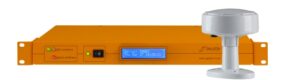
The GPS system is basically a constellation of satellites (currently there are 27). These satellites each contain onboard an atomic clock (actually two are on most GPS satellites but for the purpose of this explanation only one need be considered). The signals that are transmitted from the GPS satellite contain several pieces of information sent as one integer:
* The time the message was sent
* The orbital position of the satellite (known as the ephemeris)
* The general system health and orbits of the other GPS satellites (known as the almanac)
A satellite navigation receiver, the kind found on the dashbopard of your car, receives this information and using the timing information works out the exact distance from the receiver to the satellite. By using three or more of these signals the exact position can be triangulated (four signals are actually required as height above sea level has to be worked out too).
Because the triangulation works out when the time signal was sent and how long it took to arrive at the receiver, the signals have to be incredibly accurate. Even a second of inaccuracy could see the navigational information out but thousands of kilometres as light, and therefore radio signals, can travel nearly 300,000 km each second.
Currently the GPS satellite network can provide navigational accuracy to within 5 metres which goes to show just how accurate atomic clocks can be.